Our New Product

Exabit - Vessel Monitoring System

Your ultimate solution for real-time vessel tracking and fleet management

ABOUT US

Redbit Indonesia is a company engaged in information technology, mapping and regional modeling (GIS) which is supported by more accurate data retrieval through modular sensors and mobile apps. This company was founded in 2018 and has handled various projects both at the Ministry, Central and Regional Government, and the private sector

GIS Consultant

SENSOR MODULAR (INTERNET OF THINGS)

We offer a variety of products by utilizing various sensors for real-time data retrieval

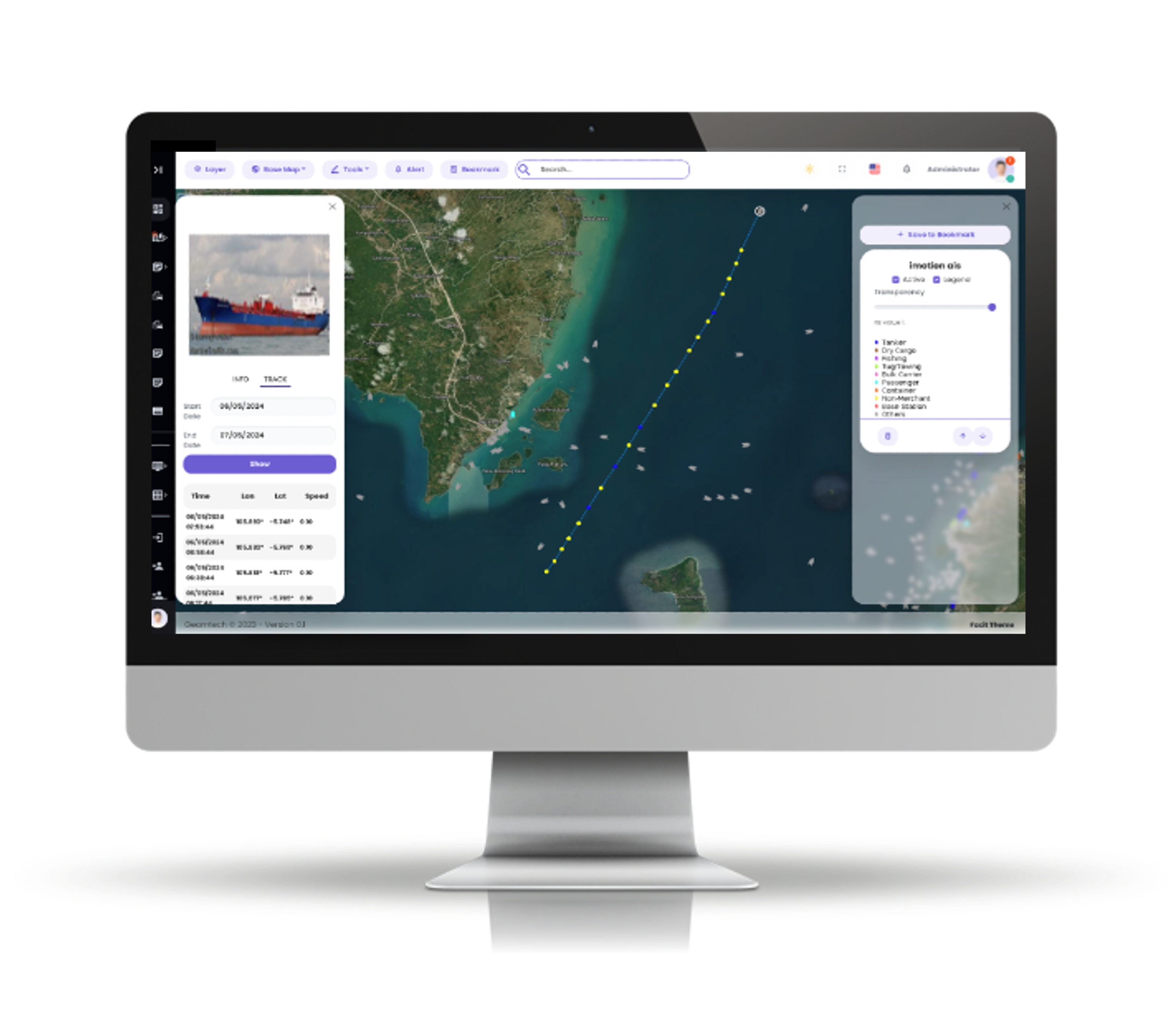
WEB MONITORING SYSTEM

An attractive form of visualization (dashboard) for monitoring data in real-time with several additional features such as analytical data and predictive data
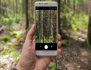
MOBILE APPS

Smartphone application based on Android and IOS that helps to get data in the field complete with the coordinates of the data obtained.


We Were Just Looking at Maps

Rick Riordan, The Battle of the Labyrinth

OUR SERVICES

GIS Desktop

We provide solutions to each of your problems using spatial analysis

Sensor Integration

Integration of various hardware or sensors to measure environmental conditions such as weather, location of moving objects through the WebGIS dashboard

WebGIS Services

Online GIS to produce an interactive and easy to understand interface

Dashboard Monitoring

Monitoring system to display data, maps, charts in real-time

Mobile Application

Mobile application used for data collection in the field, monitoring system equipped with maps and geo tagging

Spatial Database

Solutions for storing various spatial information

OUR PRODUCT

Exabit

Vessel Monitoring System

Revolutionize Your Maritime Operations with Exabit’s Vessel Monitoring System (VMS) Welcome to Exabit’s Vessel Monitoring System (VMS)—your ultimate solution for real-time vessel tracking and fleet management. Powered by cutting-edge GPS technology and seamless satellite communication, our VMS delivers unparalleled accuracy, compliance, and efficiency for modern maritime operations.

    Features

  • Real-time Tracking Know where your vessels are at all times with precise, up-to-the-second data.
  • Intelligent Insights Transform data into actionable decisions using our powerful analytics tools.
  • Operational efficency Optimize routes, save fuel, and boost your fleet's performance effortlessly.
  • Geofencing virtual boundaries for vessels, enabling real-time monitoring and instant alerts when they enter or exit predefined geographic areas.
  • API Integration VMS can be integrated with other maritime systems, such as radar systems, weather monitoring and satellite imagery, to provide a comprehensive understanding of the maritime environment.
  • Alert and notification Several anomalies and potential fraud can happen in open sea. Some occurances can be tracked, monitored and alerted on VMS

Demo

34

Projects Finished

2190

Days of Works

282350

Lines of Code

2427

Cup of coffee


True Navigation Begins in The Human Heart. It's the most important map of all

Elizabeth Kapu'uwailani Lindsey

OUR PORTOFLIO

Some of the work we have done in various fields

Geocoding of Health Facilities

Get the coordinates of health facilities in the South Jakarta area

Dashboard EWS

Dashboard, Basemap, IoT, Telemetri, Early Warning System

Webgis Dam in Indonesia

Dam Distribution, IoT, Early Warning System, Real-time CCTV

Drainage Mapping

Basemap, Early Warning System, Android Apps, DAS Bengawan Solo

Android BWWS

Basemap, Early Warning System, Android Apps, DAS Bengawan Solo

WebGIS Plant Distribution

Distribution of types of plants / vegetables in Indonesia, amount of production

OUR CLIENT

Some of our clients have done in various fields

FIND US ON THE MAP

PT Redbit Teknologi Indonesia

Cibis Nine Building 11th Floor
Jln. TB Simatupang No 2 Cilandak Jakarta Selatan 12560
(021) 2297 8262
info@redbit.co.id